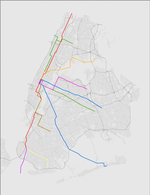
Redditor northsider1983 overlaid the CTA on New York City, and vice versa.
Puts into perspective how much room to grow Chicago has.
Also puts into perspective how much more dense our transit service could stand to be. 10 points to whoever overlays Paris's Metro map on Chicago...
See <a href="http://www.skyscrapercity.com/showthread.php?t=1480440> post 12</a> for Paris.
The CTA system has been portrayed the wrong way and backwards (North/South & East/West) are flipped. Jast saying...
Sloopwatcher is right... but still a neat little graphic; the click-through has the MTA lines in a deeper link. Good stuff.
Post a Comment

5 comments:
Puts into perspective how much room to grow Chicago has.
Also puts into perspective how much more dense our transit service could stand to be. 10 points to whoever overlays Paris's Metro map on Chicago...
See <a href="http://www.skyscrapercity.com/showthread.php?t=1480440> post 12</a> for Paris.
The CTA system has been portrayed the wrong way and backwards (North/South & East/West) are flipped. Jast saying...
Sloopwatcher is right... but still a neat little graphic; the click-through has the MTA lines in a deeper link. Good stuff.
Post a Comment