
With some nifty interactive technology DNAinfo put the question out to their readers to define different neighborhoods in the city. Not surprisingly, there isn't much of a consensus for our neighborhood.
We've gotten a fair amount of emails on the topic and given our love for the hood figured we would weigh in (take if for what it's worth). Since this question has been asked to us before, we even have a page on our website dedicated to clarifying this topic - something we call the Sloopin map.
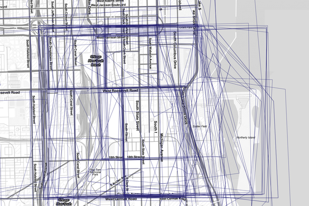
Just in case anyone wonders what constitutes sloopin, here is a general map of what we consider the "sloopin" area:

It mainly focuses on the blue area (South Loop and Printer's Row) but for good measure we also consider the red area (Near South Side) and green area (?) part of sloopin. With these parameters set, we essentially try to keep readers up to date on anything that's going on in the area.
Occasionally we'll have posts on things outside of our jurisdiction, but in some way all postings should have some relation to the sloopin areas.
So in case you can't tell by the map we define "the South Loop" as Congress on the north, Michigan/Lake Shore on the east, 18th on south and the river on the west.
But let's be honest, none of this really matter. It's fun to debate, but at the end of the day neighborhoods are typically defined/created thanks to real estate marketing and businesses trying to associate with neighborhoods that will help their bottom line.
Anywho...let us know what you think and/or join the conversation at DNAinfo.
(Hat tip: DB, AT, ND, CC!)
No comments:
Post a Comment