
 |
| From flowingdata.com |
Anyway, we recently stumbled upon a "Where People Run" map on flowindata.com:
There are many exercise apps that allow you to keep track of your running, riding, and other activities. Record speed, time, elevation, and location from your phone, and millions of people do this, me included. However, when we look at activity logs, whether they be our own, from our friends, or from a public timeline, the activities only appear individually.
What about all together? Not only is it fun to see, but it can be useful to the data collectors to plan future workouts or even city planners who make sure citizens have proper bike lanes and running paths.Here is what the maps showed:
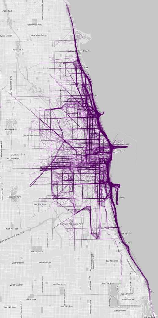
The maps below (click here for other maps) are what I got, mostly for American cities, but there are a few European cities in there too (alphabetical order). If there's one quick (and expected) takeaway, it's that people like to run by the water and in parks, probably to get away from cars and the scenery. In the smaller inland cities, there seem to be a few high-traffic roads with less running elsewhere.
Here is the Chicago map zoomed in on the Sloop. Not surprisingly the most traffic is along the lake, museum campus, Northerly Island and Grant Park:
 |
| From flowingdata.com |
Yeah maps!
No comments:
Post a Comment